There's lots of tips, trick and advice going around.
It's easy to get confused.
Should you carry a personal locator beacon or a satellite phone?
What outback maps, GPSrs or compasses should you use if you're going somewhere like Lake Eyre?
Fortunately, there are some things you can do to make it much safer, without taking away from the adventure. Here are six tips for doing just that.
1. Prepare.
I've seen people on remote tracks in Central Australia in 2WD vehicles with very little water, no food or recovery equipment. I've had to pull them out of sand traps or given them fuel and water.
The Ernest Giles Road, 150km south of Alice Springs is particularly notorious for this.

Many tourists underestimate the time needed for the trip and the kind of vehicle needed.
If a sign in outback Australia says '4WD Recommended', it means it.
This kind of road will not be a pleasant jaunt through your local national park on well-graded dirt track.
Your 2WD family sedan will not be suitable.
2. Carry a map and compass.
I know most people have a GPS these days, but there's no substitute for knowing how to read a topographic map and use a compass.

To get the most out of your outback maps, you really need to know how to read them.
Many people lost in the wilderness have hiked or driven farther into empty country because they had no idea which direction to travel to the nearest road.
A compass is a good idea too, but be sure you know how to use it. Practice near home, and start using it before you need it, just to keep in practice (and to keep from getting lost).
3. Learn other navigation skills.
If you're a hiker, this one is for you.
Can you use a watch and the sun to determine direction? How about a stick and shadow?
Because compasses break, and maps get lost, you should know at least one or two ways to determine direction.
Also note the direction most likely to take you out of the wilderness before you start. If you remember that a highway runs along the entire south side of the area you are in, you know which way to go in an emergency.
4. Be Like Bear (Grylls).
Ok. You don't have to jump out of a helicopter into a canyon, armed with only a knife, but it is handy to learn a few basic survival skills. Remote area travel becomes safer as well as more interesting.
Knowing that sleeping under a pile of dry grass or leaves can keep you warm could save your life someday.
Learning to identify a few wild edible plants can feed you when you lose your food, and make a trip more interesting in any case. Knowing the signal plants for water in the outback could even save your life.
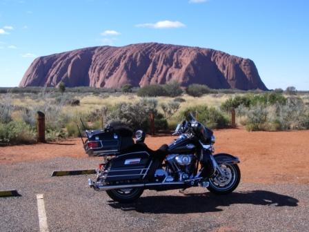
If you've taken a Lake Eyre flight, then you'll know how vast and changeable the outback can be.
Each different habitat has different plant species which mark the presence of water. Taking the time to learn these things can be very useful in a survival-type situation.
5. Have a Plan.
Rarely does anyone die from starvation in the outback.
They commonly die from exposure or thirst. In fact, the most common way people die in the outback is from heat exhaustion when walking in extremely hot temperatures.

She died from heat exhaustion and dehydration, approximately two-thirds along the track.
Her partner, who stayed with their hire car, survived and was rescued.
If you break down, stay with your car. Have extra water and even extra food.
But most of all, understand the nature of the risks you're taking and have a plan if things go wrong.
6. Get help from others.
Nobody can come to the rescue if nobody knows where you are. Leave an itinerary behind with someone. You may also want to carry a satellite phone, EPIRB or personal locator beacon (PLB).

We carry PLBs all the time - when we're offroad or hiking.
Get an extra copy of the outback map you're using and outline your route on it.
Leave it with someone responsible.
If you're heading outback, do more than read these tips. Take them and apply them.
Have a plan, understand where you're going and what to do if things go wrong. Get the vehicle, the right outback maps, and carry a personal locator beacon in your pack or glovebox.
Make sure you don't end up as a lonely grave at the end of a Lake Eyre tour.